
It was revealed in 2011 census that the trend is upward as the national population density. As per 2011 census, Bihar has the highest population density( 1,102/km2), and Arunachal Pradesh has lowest population density( 17/km2 ).
Among Union Territories, population density Delhi has the highest population density ( 11,297/km2 ) and lowest Andaman and Nicobar Islands( 46/km2).
| States | Popolation Density(sq/km) |
| Andhra Pradesh | 303/km2 |
| Arunachal Pradesh | 17/km2 |
| Assam | 397/km2 |
| Bihar | 1,102/km2 |
| Chhattisgarh | 189/km2 |
| Goa | 394/km2 |
| Gujarat | 308/km2 |
| Haryana | 573/km2 |
| Himachal Pradesh | 123/km2 |
| Jammu and Kashmir | 57/km2 |
| Jharkhand | 414/km2 |
| Karnataka | 319/km2 |
| Kerala | 859/km2 |
| Madhya Pradesh | 236/km2 |
| Maharashtra | 365/km2 |
| Manipur | 122/km2 |
| Meghalaya | 132/km2 |
| Mizoram | 52/km2 |
| Nagaland | 119/km2 |
| Odisha | 269/km2 |
| Punjab | 550/km2 |
| Rajasthan | 201/km2 |
| Sikkim | 86/km2 |
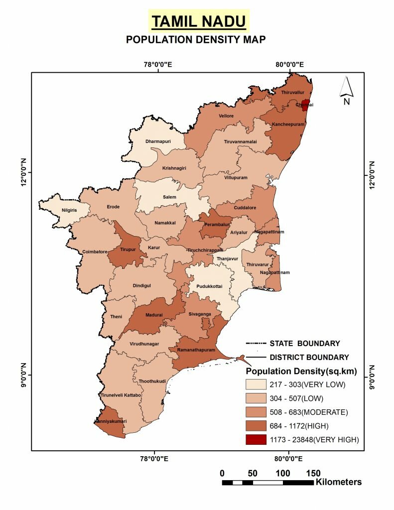
| Tamil Nadu | 555/km2 |
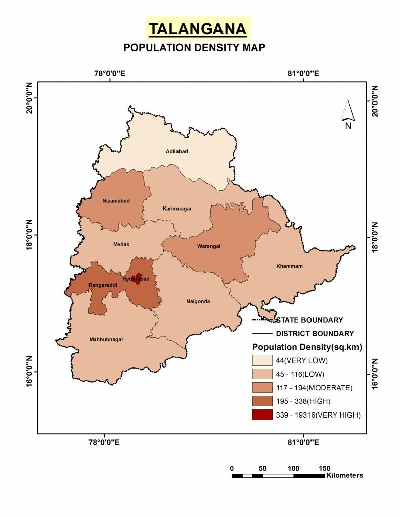
| Telangana | 312/km2 |
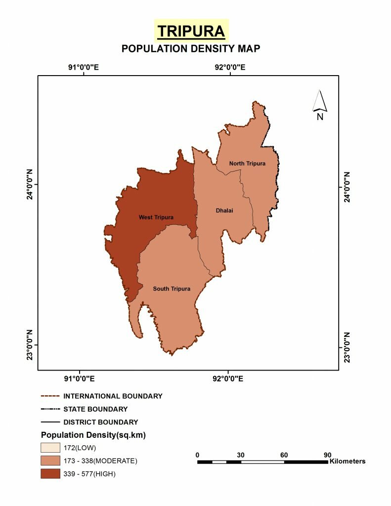
| Tripura | 350/km2 |
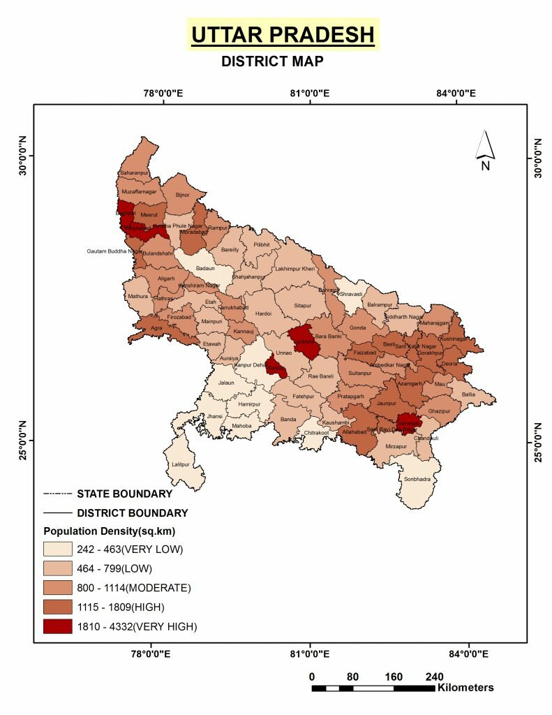
| Uttar Pradesh | 828/km2 |
| Uttarakhand | 189/km2 |
| West Bengal | 1,029/km2 |
| NCT Delhi | 11,297/km2 |
| Andaman and Nicobar Islands | 46/km2 |
| Chandigarh | 9,252/km2 |
| Dadra and Nagar Haveli | 698/km2 |
| Daman and Diu | 2,169/km2 |
| Lakshadweep | 2,013/km2 |
| Puducherry | 2,598/km2 |
-
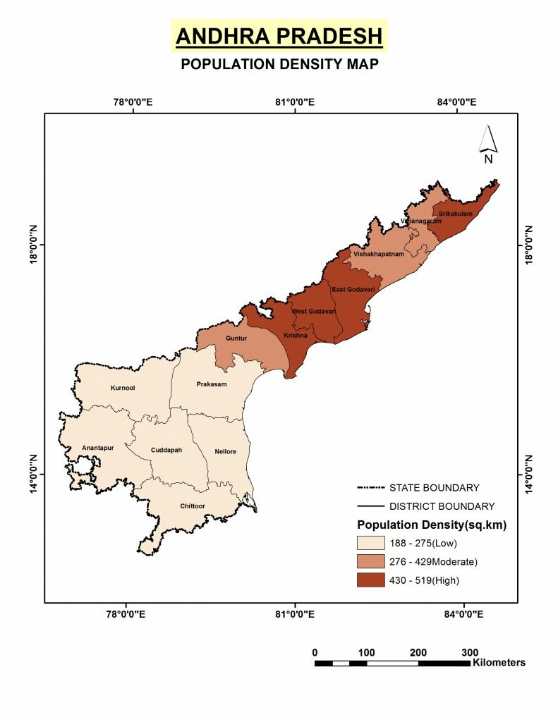
Andhra Pradesh -
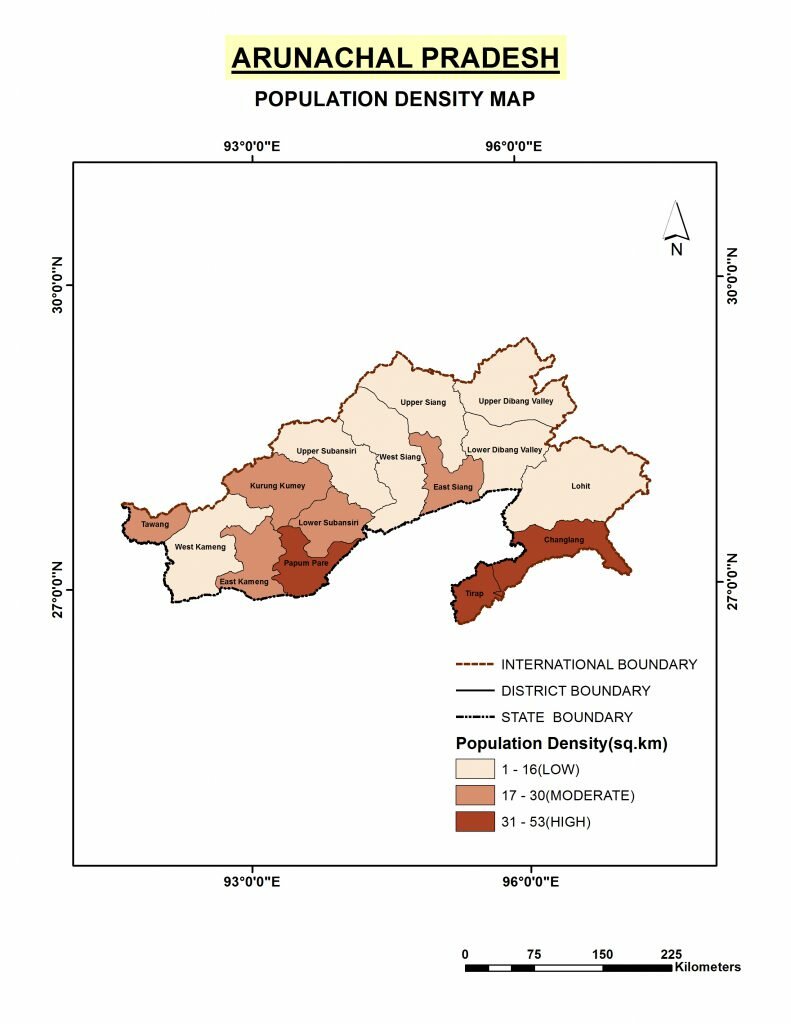
Arunachal Pradesh -
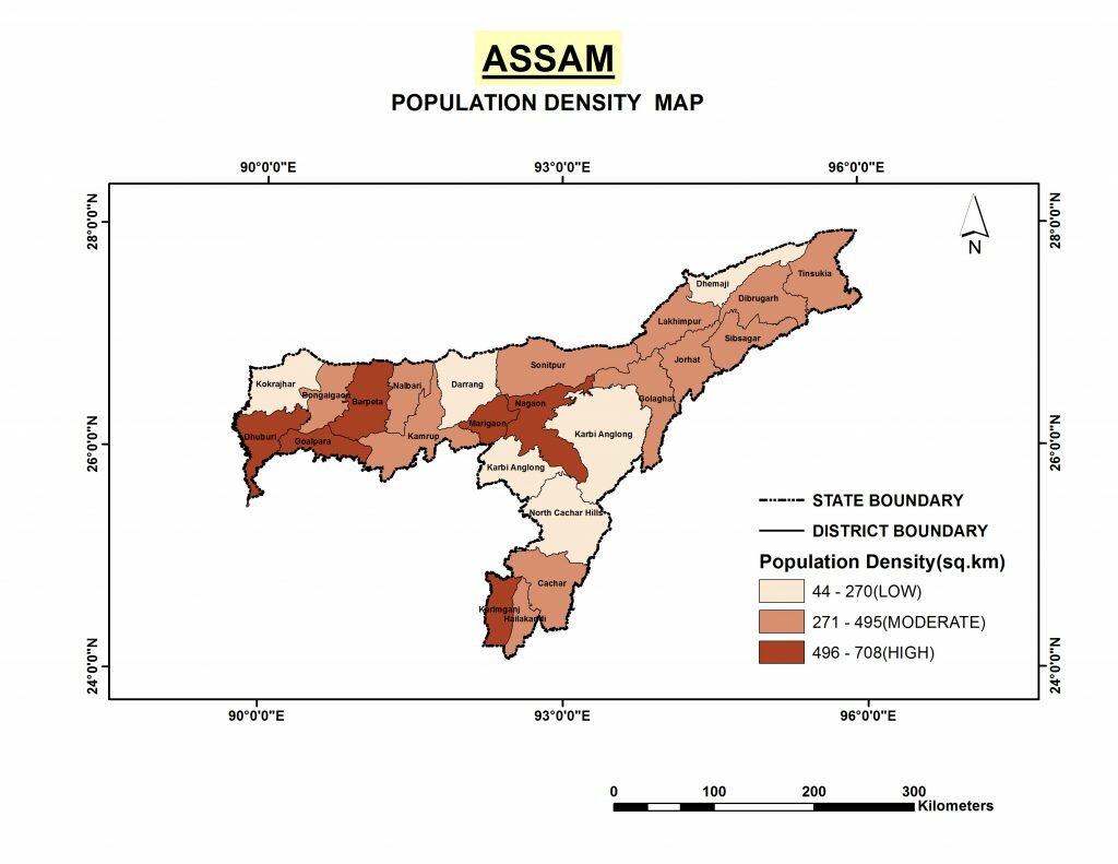
Assam -
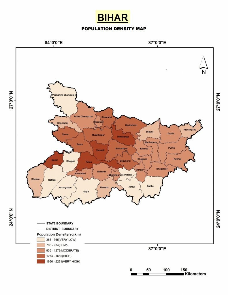
Bihar -

Chhattisgarh -
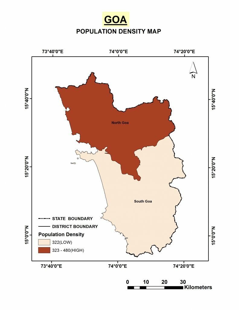
Goa -
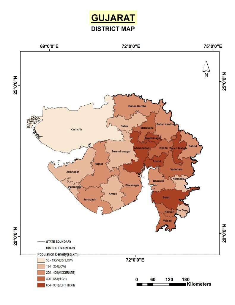
Gujarat -
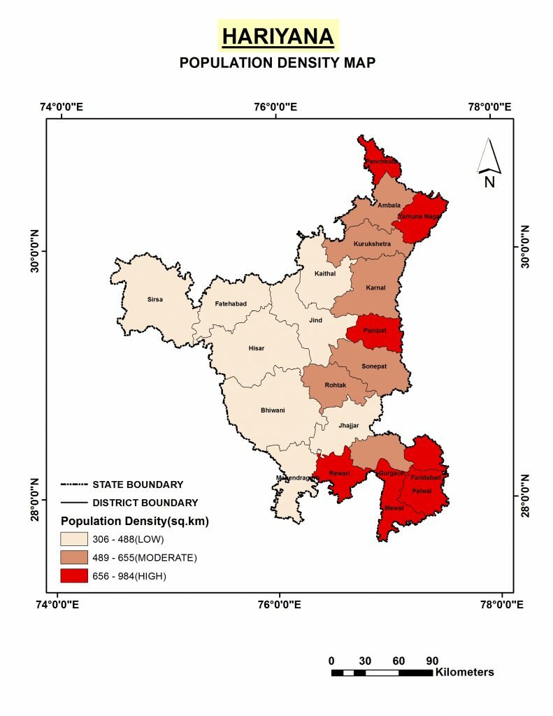
Haryana -

Himachal Pradesh -
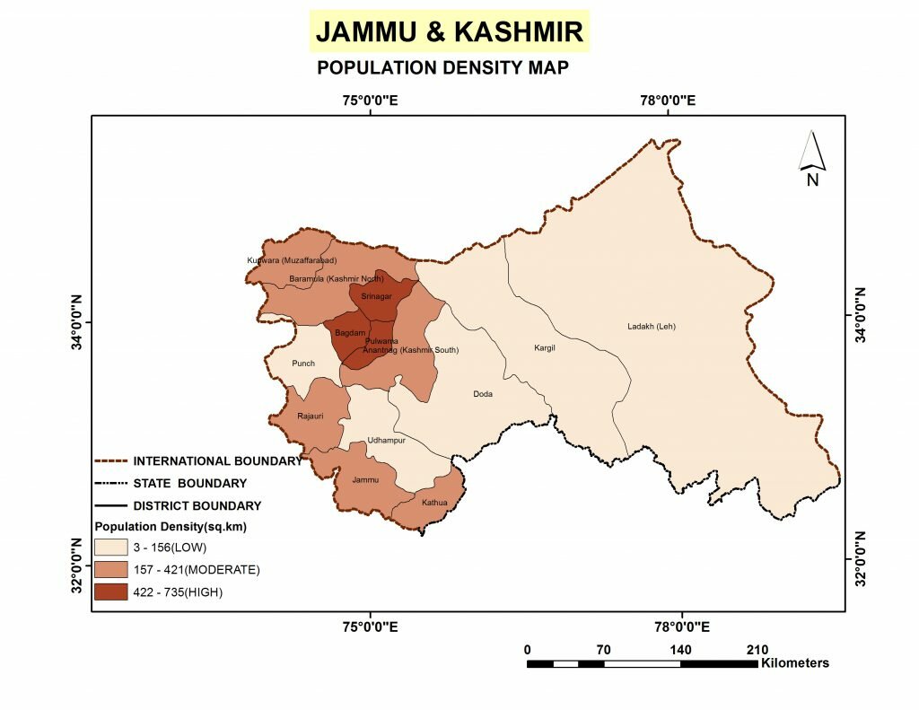
Jammu and Kashmir -
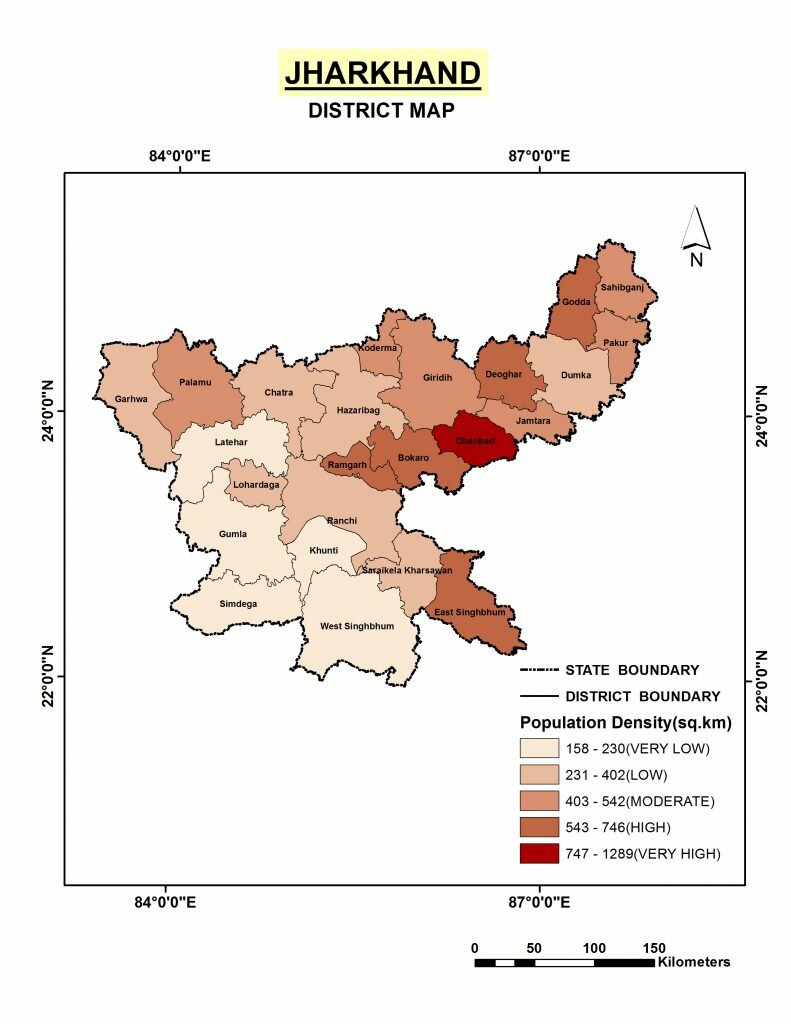
Jharkhand -

Karnataka -
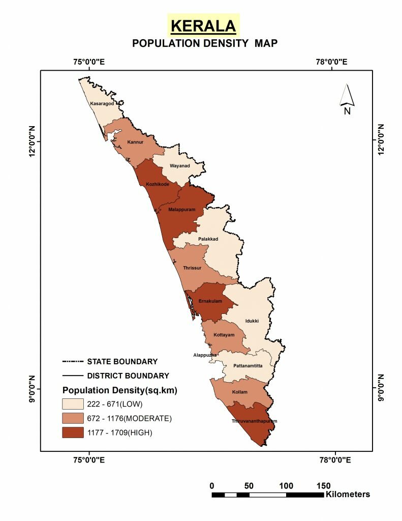
Kerala -
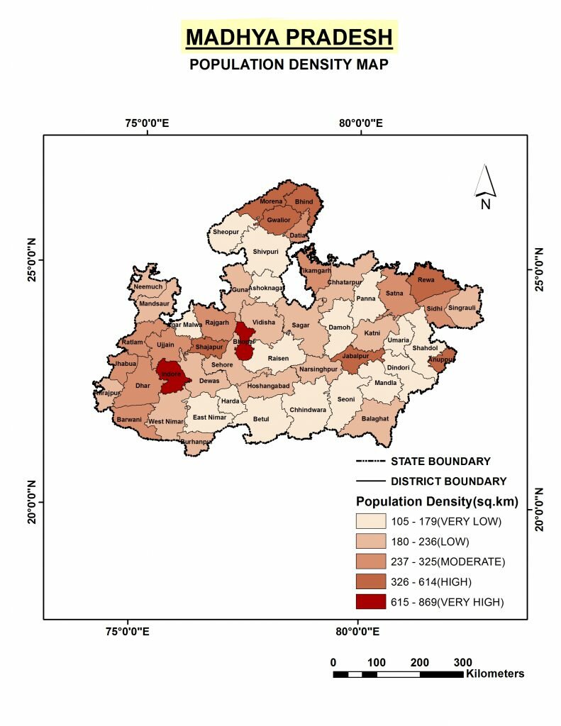
Madhya Pradesh -

Maharashtra -

Manipur -
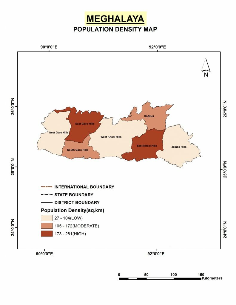
Meghalaya -
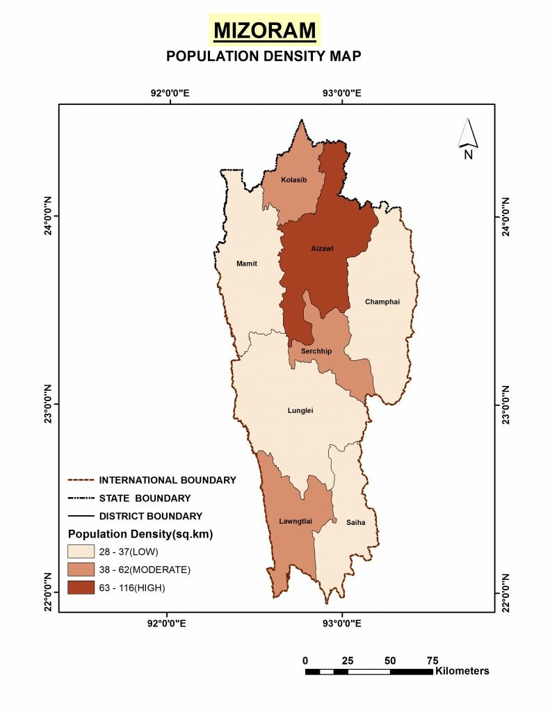
Mizoram -
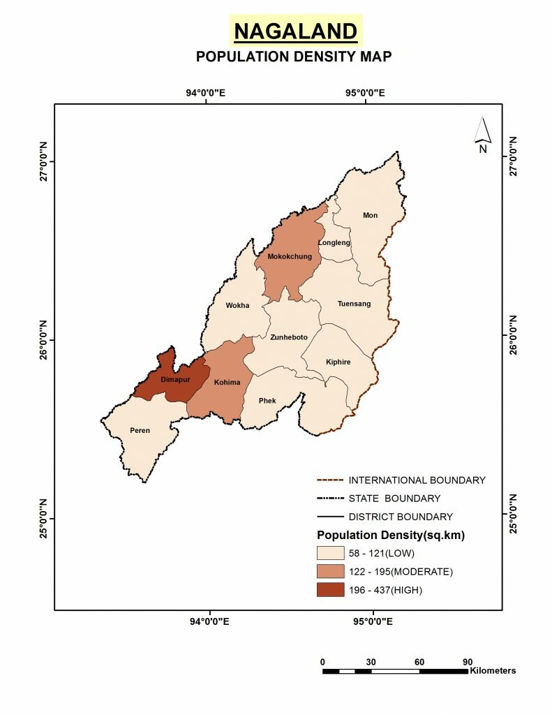
Nagaland -

Odisha -

Punjab -
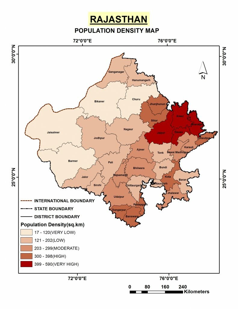
Rajasthan -
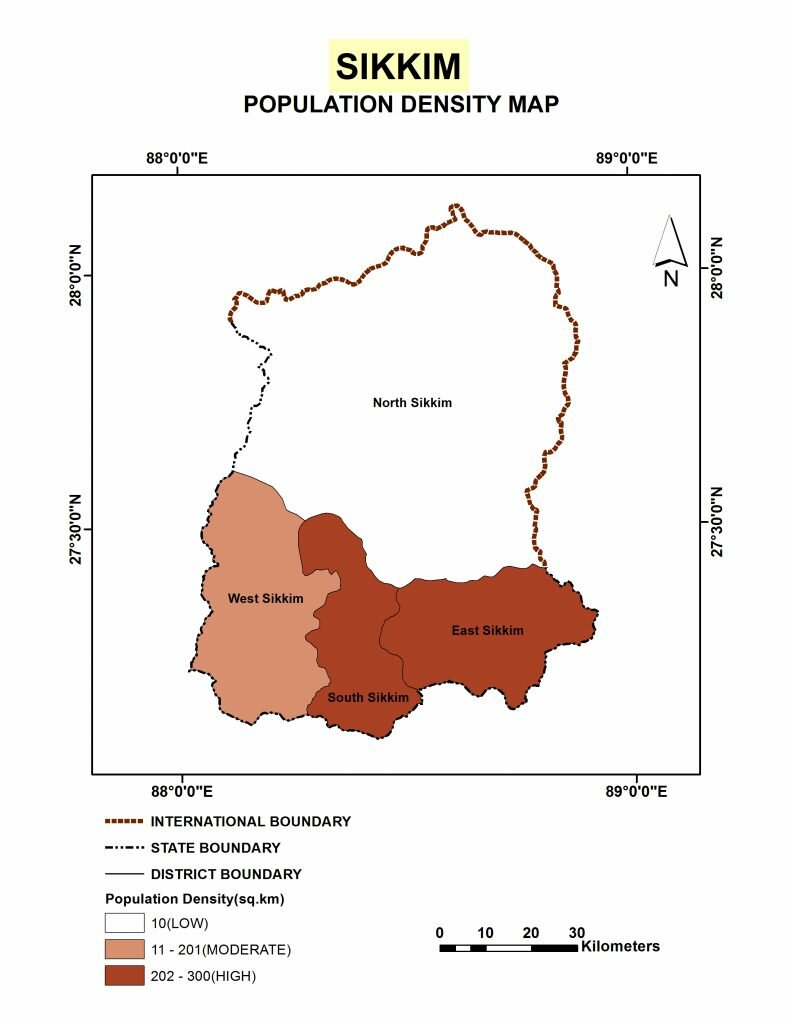
Sikkim -
Tamil Nadu -
Telangana -
Tripura -
Uttar Pradesh -
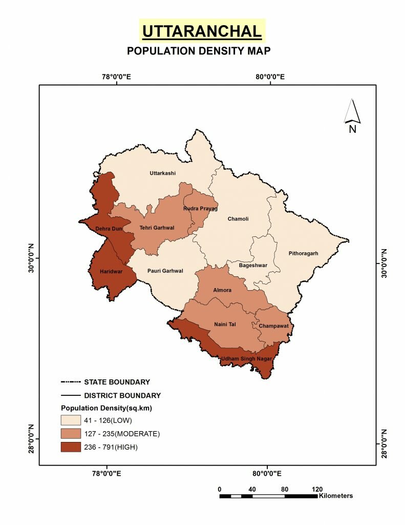
Uttarakhand -
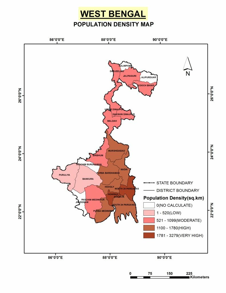
West Bengal